Evolution des états de surface sur sols nus et travaillé
4.1 Introduction
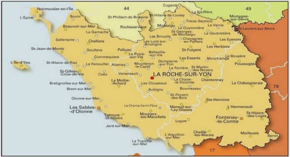
Soil surface characteristics (SSC), namely soil cover, topsoil structure and soil crusting (Casenave and Valentin, 1992 ; Leonard and Andrieux, 1998 ; Le Bissonnais et al., 2005) are known to inuence the partition of rainfall between inltration and overland ow (e.g., Auzet and Boin, 1995 ; Moussa et al. 2002). They vary largely in time and space due to many factors, among which soil variation and farming practices are the most eective (Bresson and Boin, 1990 ; Earl, 1997 ; Leonard and Andrieux, 1998 ; Sillon, 1999 ; Martin et al., 2004 ; Armand et al., 2009). Knowledge of SSC is therefore essential for predicting hydrological processes at both the eld and catchment levels. Several authors have proposed runo risk classication schemes based on SSC classication. For example, Casenave and Valentin (1992) related soil runo capability variation in Western Africa to SSC classes dened by the soil surface vesicular porosity and crusting and the amount of worm casts, whereas Cerdan et al. (2002) related potential values of inltration capacity to SSC classes corresponding to combinations of soil surface roughness, crop cover and soil crusting stage. These classications are useful for facilitating the parameterization of topsoil inltration properties in distributed rainfall/runo modelling approach (Cerdan et al., 2002). Indeed recognizing SSC variation in space and time at the catchment scale is much faster than measuring the variation of soil inltration capacities. Nevertheless, eld surveys of SSC still remain labor-intensive and costly. An alternative is to use remote sensing techniques. Numerous applications have attempted to map single soil surface attributes, like soil surface crusting (Ben-Dor et al., 2003 ; Goldshleger et al., 2004) or soil surface roughness (Baghdadi et al., 2002). Some have also attempted to map synthetic SSC classes, dened as combinations of soil surface attributes like crust development, topsoil structure, vegetation cover, etc. (Wassenaar et al., 2005 ; Corbane et al., 2008). This approach is promising but is still under development, and it requires ne temporal and spatial image resolutions given the characteristic scales of SSC variation. Another alternative is to develop prediction models of SSC from easily-accessed environmental variables, which would also allow for exploration of prospective scenarios regarding, for example, the eect of changes in agricultural practices on catchment . This is what this paper is concerned with in the specic case of the prediction of SSC changes due to tillage practices. Tillage is the agricultural management practice that has the greatest eect on soil structure. Many studies in the literature have observed and quantied the impact of tillage on soil surface conditions (e.g. Boin, 1984 ; Xu and Mermoud, 2001) and on soil physical properties (e.g. Ndiaye et al., 2005 ; Chahinian et al., 2006 ; Strudley et al., 2008). These studies have clearly shown that tillage initially increases soil porosity, removes existing soil crusts and thereby increases soil inltration properties. They have also shown that subsequent rainfalls and wetting-drying cycles favor soil reconsolidation and soil-surface sealing or crusting (Boif- n, 1984). However, only a few studies have attempted to develop prediction models of the eects of tillage and subsequent reconsolidation. Green et al. (2003) provided an overview of the advances in prediction approaches. They concluded that quantitative algorithms for computer simulations are scarce and typically limited to the short-term eects of tillage. To our knowledge, the situation has not improved since Green et al.’s review. Moreover, the rare predictive equations that are available concern only single soil properties, like bulk density, surface roughness or hydraulic conductivity (e.g. Boin, 1986 ; Risse et al., 1995) and, therefore, do not allow to predict the simultaneous change of several SSC that occur after tillage. In this paper, we present and evaluate a prediction approach of the changes in time and space of SSC classes after tillage at the catchment scale. A SSC classication scheme developed by Andrieux et al. (2001) and based on several criteria such as topsoil structure as related to tillage practices or type of soil crust, was used. Given the inuence of rainfall and general soil characteristics on the dynamic of soil consolidation after tillage (see Boin and Sebillotte, 1976 ; Dexter, 1977 ; Martin, 1999), we assume that the variation of SSC can be empirically predicted by a linear combination of (i) rainfall parameters, being the main drivers of the temporal changes in SSC in a given eld, and (ii) basic soil and tillage characteristics, determining the between-eld variations in the rates of change. The prediction method we chose is a logistic regression that allows us to estimate the probability of the occurrence of ordered events, which is here the sequence of SSC classes, and can make use of several numeric and categorical predictors. The t and evaluation of the prediction approach was performed on a data set of SSC observations taken from 2004 to 2007 in a 91-ha catchment in the south of France planted mainly with vineyards. 4.2 Materials and methods 4.2.1 Study site The study site was the 91-ha Roujan catchment (43°30’N and 3°19’E) about 60 km to the west of Montpellier in the south of France. The climate is of a sub-humid Mediterranean type characterized by a long dry season and high-intensity and short-duration storms that cause Hortonian overland ow ; it has a mean annual rainfall of 650 mm and a mean Penman reference evapotranspiration of 1090 mm (Andrieux et al., 1993). The catchment consists of four distinct geomorphological units (Fig. 4.1a) : a slightly undulating plateau, terraces hillslopes, a colluvial glacis and a central depression. The elevation ranges from 75 m above sea level in the depression to 125 m at the top of the plateau, and the slope from 2% in the depression to about 15-20% on the terraces. The main soils from the top down the slope are, according to local soil classications (and to WRB 1998) : (i) stony brown calcareous soils (calcaric leptosol) and 4.2 Materials and methods 139 1.o 2.o 3.o 4.o 5.o Plateau Chromic luvisol Calcaric leptosol 6.o 7.o 7.1 8.o 8.1 9.o 9.1 10.o Slopes Calcisol 11.o 12.o 12.1 13.o 14.o 14.1 15.o Footslopes Calcaric cambisol 16.o 16.1 17.o 18.o 19.o 19.1 Depression Gleyic calcaric cambisol 0 100 200 Meters a. b. Figure 4.1 Spatial distribution of soil and geomorphological units in the Roujan catchment. b. Sampling design stony red soils on the plateau (chromic luvisol), (ii) calcareous clay soils (calcisol) on the slopes, (iii) calcareous soils with poorly dierentiated proles and a loamy texture (calcaric cambisol) on the footslopes and (iv) calcareous soils with a medium-to-ne texture with hydromorphic features (gleyic calcaric cambisol) (FAO, 1988) on the depression. Land use in the catchment consists mainly of vineyards. During the monitoring period, vineyards covered 62% of the catchment area on average. The total number of elds in the catchment varied from 153 in 2004 to 147 in 2007, with their area ranging from 0.1 to 2 ha. A dense network of ditches, 11 km long, isolates most elds, collects overland ow, recharges and drains the shallow groundwater and routes water to the catchment outlet. Concerning the agricultural practices, a survey identied three types of soil treatments of the vineyards. In the rst one, herbicides are applied over the whole eld without any tillage. Consequently, soil surface characteristics remain the same throughout the year. In the other two treatments, herbicides are applied only along the vine rows, whereas the inter-row is tilled one to four times per year or covered permanently with grass. In these last two soil treatments, the soil surface characteristics vary with time due to tillage or changes in the extent of grass cover.
Classication of soil surface characteristics
Here we focus on the description of SSC in the Roujan catchment on the tilled vineyards, which during the study period corresponded to 86% of the vineyards and exhibited a large temporal and spatial variation of SSC. To distinguish between the various SSC that can be observed on the tilled elds, we followed the classication of SSC resulting from a work by Andrieux et al. (2001) on the same site. These authors classied the SSC according to the observed soil cover, topsoil structure and soil crusting and showed that the distinguished classes have dierent inltration properties as measured by rainfall simulation. Here we use only the part of the classication describing the SSC in the tilled vineyards. They are represented in Fig. 4.2. They correspond to dierent stages in the evolution of the soil structure of the vineyard soils due to the eect of tillage and of natural reconsolidation by raindrop impact and redistribution of soil particles by splash and ow (e.g., Robinson and Philips, 2001) : (i) The rst stage, named recently tilled and in short T, corresponds to the stage just after tillage when the soil porosity increased, the topsoil structure loosened and the surface crusts if any were destroyed. In the eld, this stage is recognized by a fragmentary structure of the soil surface with clods and particles clearly distinguishable and the absence of any crust. (ii) The second stage, named formerly tilled and in short TCst, follows the T stage. It still exhibits a loose topsoil structure but a thin structural crust has formed over at least parts of its surface. In the eld, this stage is recognized by a still very rough soil surface that is partially to totally closed with a thin and porous structural crust. Soil clods must remain visible even under the crusted part of the soil surface since at this stage the crust that has formed only covers the soil surface but has not altered signicantly the underlying soil structure. (iii) The third stage, named crusted and in short Cst, is the nal state of soil reconsolidation after tillage. The topsoil is recompacted and a continuous structural crust with a thickness larger than in the second stage overlays it. In the eld, this stage is recognized by a totally closed soil surface with a continuous and consolidated structural crust, a compacted topsoil structure with soil clods that are no longer visible from the surface.